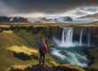
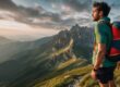
Located in western Colorado outside the town of Montrose is one of Americas hidden natural wonders. At 2,722 feet deep, with brilliant black wall, Colorado’s Black Canyon of the Gunnison National Park features one of the most dramatic canyons on the world. Some parts of the canyon will not see the sun for months giving the area its name. Beyond its stunning vistas, the park offers ample room for activities like hiking and campaign. In fact visiting Black Canyon of the Gunnison park – hiking the Gunnison Route has been on my bucket list for a while.
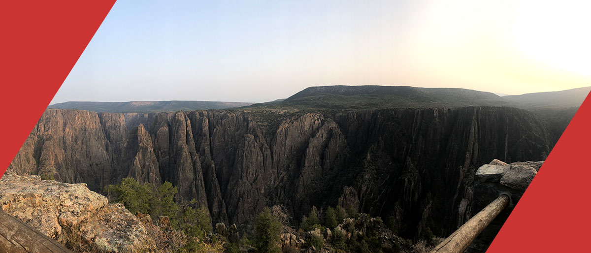
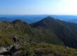
Unlike other canyons where most people make the trip to the bottom, at the Black Canyon there is no easy way down. No mule paths. No switchbacks beyond the first .25 miles at all. Just 1,900ft of straight drop and loose rocky scree. Combined with a rigid permit process most people will never touch the bottom of the canyon. Making it even that more beautiful and for adventures like me, even more alluring.
Black Canyon of the Gunnison -Hiking the Gunnison Route
How to Get There
Black Canyon of the Gunnison National Park has a north and south rim and north and south rim visitor centers. If you want to hike the Gunnison Route you will be getting your permit at and leaving from the south rim visitor center.
How to Get a Permit to Hike the Gunnison Route
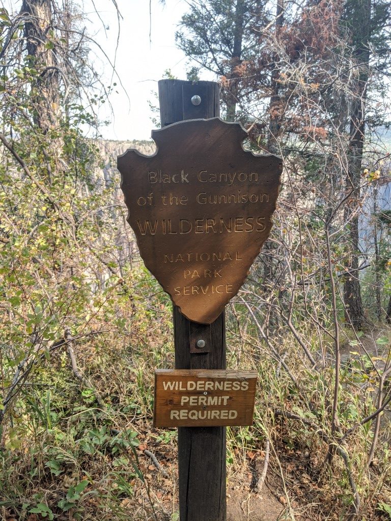
To hike any route down the Black Canyon will require getting a permit. The catch is that they only release 15 permits per day. 15 permits means 15 people. They start handing out permits the day before, and for us started at 3:30pm and the all of the permits were spoken for by the time we left so I’d recommend getting there around 3pm to be safe. Permits also allow you the ability to camp at the bottom for 1 night.
Where to Stay
Here you have a couple of options. You can camp at the park or you can stay at the near by city of Montrose. This is only about 20 minutes from the south rim visitor center making it the perfect rest over.
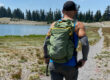
What to Bring
Hiking Shoes –
Backpack –
Gloves – I recommend these Grease Monkey Gloves, cheap and available everywhere.
Food – Bring at least 1 item of food for every 45 minutes you plan on being on the trail to be safe.
Water – 2-4 liters based on time day and year.
Water Filter – Cut your water weight in half and just fill up at the bottom. I always carry my Sawyer Squeeze.
Make sure to check the weather and preview the map. Both below!
Black Canyons of the Gunnison Weather
Black Canyons of the Gunnison Map
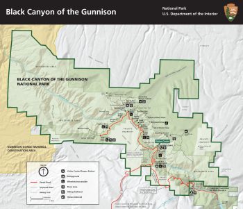
Link to NPS.gov Black Canyons of the Gunnison Map Click Here
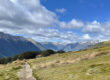
Hiking the Gunnison Route
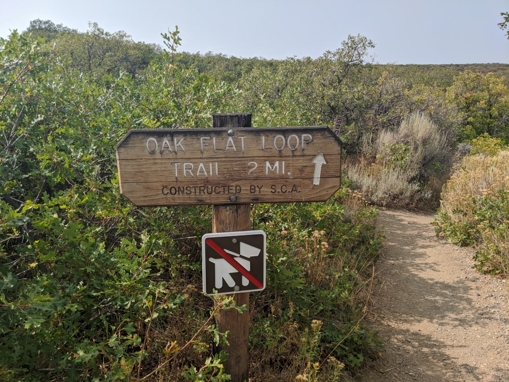
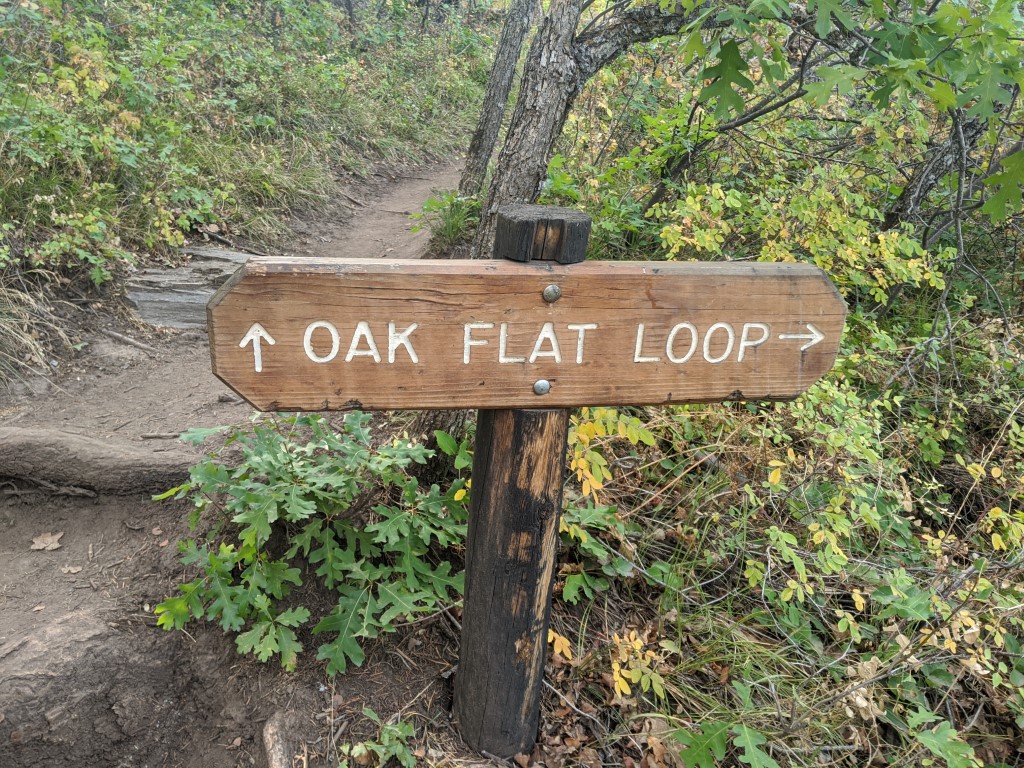
The Gunnison Route leaves from the south rim visitor center and starts along the Oak Flat Loop.
At the first split you will take a right.
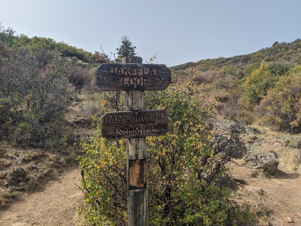
Then at the next split take another right.
And finally be on the lookout for the last sign and take another right.
From here the real fun begins. You will go through a few switch backs and then things will get really steep, really fast. Make sure you are looking back up point to keep the trail. There are few points where the trail splits and while you may think you couldn’t miss it, it can be easy to miss a turn when you get trail vision on the way up.
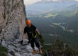
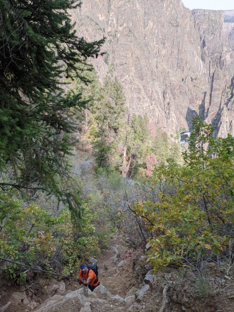
About half way down you will come across the infamous metal chain. This thing is 80ft long and weighs a bit more than you would expect. It makes going both ways much easier. It extends beyond what you can see in the picture below.
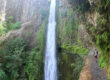
From here the trail gets pretty straight forward but a bit technical with the slope and scree. Just be careful and make sure to take time to enjoy the view. Keep following this all the way down and make sure to plan some time down at the river.
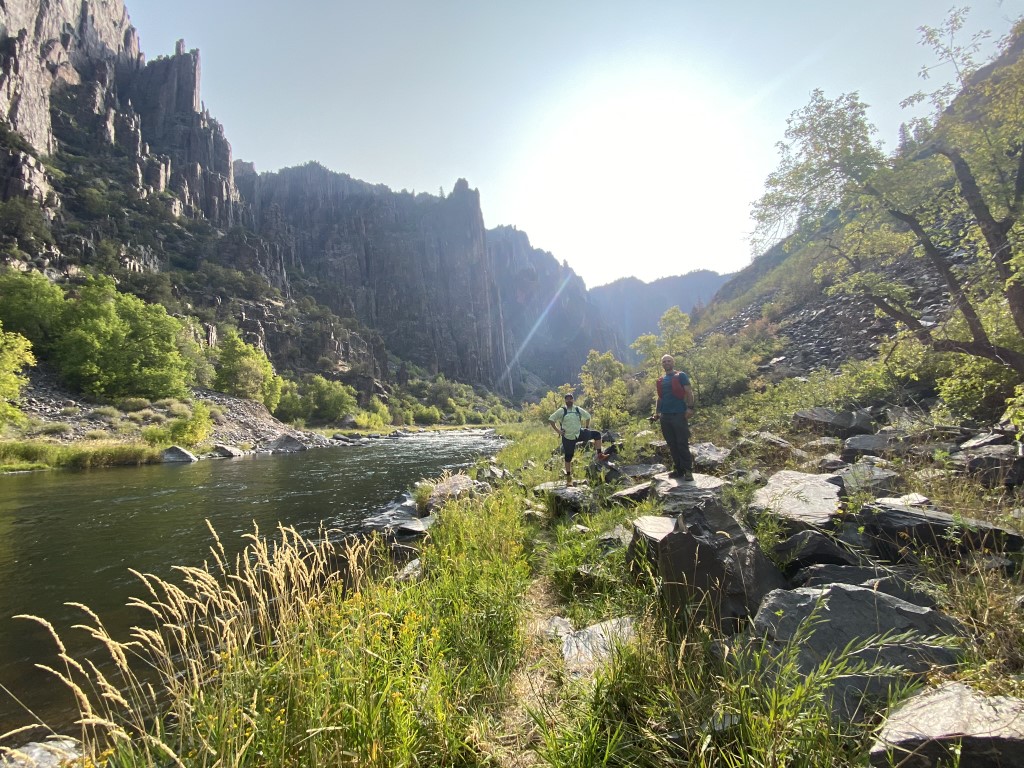
Once you get to the bottom it’s time to take it all in. Eat some food, soak your feet, and enjoy the view.
The hike back up is doable and some people prefer it to the way down. It’s definitely easier to find stable footing on the way back up. Just make sure to pick your head up while hiking. Its easy to get trail vision and miss the trail as it makes some quick hitches right and left. These flow on the way down but are easily missed on the way back up