In a world where all of the toughest ultra races either sell out or face a lottery to get in, the Hellbender 100 stands out. Running through the Black Mountains overlooking the popular beer-drinking town of Asheville, NC, it’s an idyllic location for a trail race, in an area known for trail running and the outdoor lifestyle. Yet there’s no lottery, and the race is probably not going to reach capacity. This race is different. In a sport where athletes actively seek out the tough races, the Hellbender 100 scares even the craziest of ultra runners. So below is my 2023 Hellbender 100 mile race report, hoping to give you some insight and tips on how to conquer this true beast coast classic!

The Hellbender 100 Mile Race Report – 2023
Race Website: Click Here
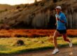
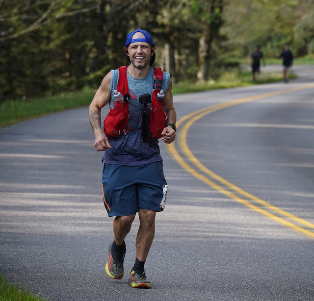
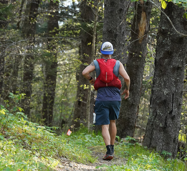
Photo Credit: Peter Schreiner
It’s not just trail running; it’s a remote battle with nature along some of the most technical trails you will find featured in any 100-miler. There are 5 climbs and descents over 3,000+ feet, and you will use your hands and rope to maneuver over the highest ridge line east of the Mississippi. With roughly 24,000 feet of gain, and 17,000+ feet coming in the first 50 miles. But if you have been reading my blog long, then you know I’m a sucker for a challenge. And also lucky enough to also have a friend crazy enough to pace me for over half the race. Along with my pacer and two person crew of my mom and girlfriend. We all made the four hour drive out to Old Fort, North Carolina. Ready to face the unknown and a adventure that lies ahead.
The Venue and Sign-In
The Hellbender 100 takes place in Old Fort, North Carolina, located roughly 30 minutes from downtown Asheville. Old Fort is considered the gateway to the Black Mountains and features a population of roughly 45 residents living there full time. The town itself is small but nice, featuring a few little restaurants and a couple of breweries, including the Old Fort Hellmans Brewing location, which was voted the best brewery in NC in 2023. The food there is great too. We were also able to find a few great Airbnb options right in town and less than 10 minutes from the start of the race.
The race check-in, start, and finish are all held at Camp Grier, an old boy scout camp turned into a recreation area. It’s a little piece of heaven. I would love to come back to actually enjoy it sometime. Getting into the venue is a drive on a single-lane dirt road which can get congested from the mandatory meeting. And a car will easily make the drive, but some of the parking is angled, so if you have an SUV or truck, that’s probably best.
Check-in went very smoothly, and they didn’t check any of the mandatory gear until the next morning. One note, they didn’t have any extra gear for sale. So if you want something, make sure to order it on Ultra Signup in advance.
Race Morning to Aid Station 1
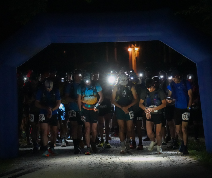
The race starts at 4:30 am on a Friday. So it’s an early start. Make sure to take that into account if you plan on staying in Asheville. I’d highly recommend staying closer. And know that they even offer some onsite camping and bunk options, which will all be included in the pre-race packet. Getting to the starting line was a breeze, and the overall size of the race makes it feel like a smaller event. Which it is. In 2023, only 100 racers started the course. This one is not for the weak of heart.
Getting going into the night, the trail is incredibly straightforward, taking you onto the Jarret Creek fireroad for the entire length to the first Jarret Creek Aid station. This section of road has a bit of gain, but it flows really well and allows you to get warmed up for the first big climb. The start of this race can feel fast, but be careful.
Heartbreak Ridge to Curtis Creek
You will continue on the Jarret Creek fire road for a short climb after Aid Station 1, before you hang a right and the real fun begins as you make the push up Heartbreak Ridge to the Blue Ridge Parkway. A 3,000+ ft climb that will take you into the light of the day. The climb itself is very straightforward. Heartbreak Ridge is a well-known downhill mountain bike run. So the grade isn’t too bad. But some sections will have you questioning people riding down the boulder-laden path. Which eventually opens up to a short downhill leading to the parkway crossing and a water-only aid station.
Once you hit the road, you will take a left and go probably ¼ mile before taking a right down the trail. You are about to enter the flowiest section of the race. And if there was ever a time to make up a little time, it’s here, early in the race. The danger is knowing how much to give over the next two sections, with a lot of runners coming out too hot, underestimating the massive change to the technical trail ahead. For now, that’s on in the future, so just enjoy some flowy single track as you fly into South Toe Aid station for the first time.
Leaving South Toe, the flow continues as you lose over 2,000+ ft after a short climb out of the aid station. On the descent, the trail will turn from single track into fire road as you enjoy by far the fastest part of the course. So just pick up your legs and fall forward into the Curtis Creek aid station. And enjoy a short break because the real test is just about to begin.
Curtis Creek Aid Station to Neal Creek Aid Station
Heading out of the Curtis Creek Aid station, the course sends you up Snooks Nose and to Green Knob. This may be the steepest section of the trail, with massive grades that push for hundreds of yards before providing a turn for a break. I don’t even think the pros are running these. Towards the top, there is a ton of exposure, and you can expect to be here in the heat of the day. There were a couple of drops caused by this section. Once you make the rocks at Snooks Nose, be careful; this area is known to be a literal snake’s nest. Just read the AllTrails comments.
Leaving the rocks of Snooks Nose, the trail’s grade eases a bit as you make the push to the Blue Ridge Parkway for the second time. The trail is straightforward but relentless. And the sound of the cars on the parkway puts a smile on almost every runner’s face. But don’t get too happy. Once you hit the road, you still have the Green Knob water tower climb, a brutal short finish before making the long technical push down to Neals Creek aid station. That’s right, don’t expect any flowy trail from this point on. This descent will be much slower than the first and just a taste of what is to come ahead. From here, it is almost all downhill into the aid station, and you’ll be thankful they don’t send you back up that monster on the way back.
Neals Creek to Mt Mitchel Aid Station
Into the teeth of the beast, you’ll be hard-pressed to find a harder 15-mile section in any 100 miler, anywhere. This next section takes you up the Mount Mitchell Trail. The trail is technical, gaining a steady 600-700 feet per mile for 6 miles, topping out at the summit of Mount Mitchell, the highest point on the East Coast. This entire section—the climb, ridge, and trail down—really eats people. So it’s important not to go too hard on this climb. That said, I was feeling great through this section and ended up catching and passing a lot of people here. I actually beat my time up the mountain compared to my training run 6 weeks earlier without even trying. The training paid off!
Once you tag the peak, you’ll pull into the Mount Mitchell Aid station before heading out to tackle 4 miles of the Black Mountain Crest Trail. Here I would sit with my crew and grab my poles. I don’t typically use running poles, but I know the trail ahead and the Colbert Ridge descent. Leaving Mount Mitchell, you are heading into the most technical trails of the race. And don’t expect a descent any time soon.
The Black Mountain Crest Trail to Colbert Ridge Aid Station
To quote Dave, a runner I met from California, “I don’t know how you tag the highest point on the East Coast and still somehow feel like you are going straight up… but they found a way.”
“I don’t know how you tag the highest point on the East Coast and still somehow feel like you are going straight up… but they found a way.”
Dave From California

That quote encompasses the Black Mountain Crest Trail as you tag Mt Craig, Big Tom, and others. Using your hand and providing ropes to climb up and down the near-vertical slopes. This section is incredibly slow, like 30+ minute miles while giving effort. And it goes on and on and on…
Eventually, you will make the turn off to the Colbert Ridge trail descent. But don’t expect to make up any time here. It’s extremely technical, nasty, up and down, filled with giant roots, rocks, and drops. This will level out into some very runnable trail towards the bottom. It’s just a question of how much you will have in your legs after the last two sections. For me, though, getting to Colbert Creek meant picking up my pacer and new life.
The Buncombe Horse Trail
Sitting at the Colbert Creek Aid station, I had two thoughts going through my head. One, I was thrilled to be picking up a pacer. And two, I’ve got a couple of really noticeable hot spots on my feet from the 100% humidity and balancing on rocks. So I lube up the feet real good and hit it back on the trail. I thought about changing my socks, and in a clearer mind, I probably should have, but it wouldn’t matter. As we got about 2 miles into the next big climb, the sky opened up and started pouring. It was an intense 45+ minute downpour. So anything dry was going to be wet anyway.
The climb back up really didn’t feel too bad. The trail up would have been relatively nice had it not been pouring rain. And making it to the top, the trails start to level out a bit, taking you along the side of the mountain. This next section was my least favorite of the entire race. The area itself never seems to be dry and features a mile plus of slick logs to help you stay above the consistently flooded trail. Throw in the torrential rain and you had logs that were underwater and miles of trail just trying to rock hop to stay out of six inches of tacky mud. It literally took the shoe right off of my foot, leaving me with two muddy socks for the next 15 miles of trail.
As you follow the Buncombe Horse Trail, you make your way back up and around Mount Mitchell without going to the peak. You will actually cross the Mount Mitchell Trail before making your way down to the Camp Alice aid station. Leaving here, the trail eventually starts to dry out as you dive back into the darkness of the Black Mountains below. This would be a very lonely section of the race if you were running alone. Eventually, the trail pops you onto a fire road leading to the warmth of a roaring fire at the Buncombe aid station.
To Neals Creek and Curtis Creek
Leaving the Buncombe Horse Trail aid station, you have just a short 4.3-mile section. While it starts off on a fire road, it quickly diverts you into the woods on a side trail just for some extra vert. You can literally see the flattish downhill grade of the fire road from the trail… It taunts you as the trail staggers up and down the hills’ steep sides. And of course, there’s lots of fun off-camber stuff. That said, this may be the easiest section of the entire race. So enjoy it.
Pulling into Neals Creek, my feet are on fire! I can tell I have two blown-out blisters on my heels, and lord knows on my toes and underfoot. So I quickly kick off my shoes and socks for a new set of both. While my pacer, Kyle, mans up and pops two of my blisters and wraps duct tape around my feet. “You good?” he asks. “Oh yeah, let’s do this,” and we are off.
Leaving Neals Creek this time, thankfully you don’t have to make the climb back up and over Green Knob and Snooks Nose. Instead, you get to go around with a much shorter climb. To be honest, I don’t remember much of this 8.4-mile section. While the duct tape is holding my heels, I feel both forefoots fill and eventually blow out. The pain was excruciating for the last 3 miles pulling into Curtis Creek, our last crew aid station.
Give Me All the Duct Tape
Sitting in the Curtis Creek aid station, I knew three things: my feet were in bad shape, I needed more duct tape, and that I’m not giving up. So out came the roll, turning my heel wrap into a full-blown duct tape sock. Tip: if you ever have to do this, flex your toes upward when applying the tape to maintain mobility.
Just about this time, the person running the aid station slowly wandered over to our group, checking out what was going on. I was worried she was going to pull me from the course. And as I looked at my girlfriend, I knew she felt it too. So I quickly uttered, “just 25 miles more!” in the most enthusiastic focus I could muster. Her response, “you actually have less than 24.” And I knew everything was going to be alright. We finished off my feet, ate a lot, wrapped a bunch of just-in-case duct tape around my poles, and we were off again!
Curtis Creek to the Blue Ridge Parkway
Leaving Curtis Creek, you are heading up your last big climb of the day. This one starts out easy, taking you up a long fire road, turning into a 4×4 road, and eventually transitioning into a singletrack with switchbacks to the South Toe aid station and the Blue Ridge Parkway. This section is not technical, but if you are running late in the race, it can get really hot and humid. We made the push out of Cutis Creek around 7:30 am, and I can’t imagine what it was like for those going later.
Once you reach the crest, there is a quick drop into the South Toe aid station. We made a quick stop here, wanting to get over the parkway as early as possible in the day. The climb is very straightforward and meanders up with what felt like a few false summits. The trail itself was beautiful here, but the heat definitely started cranking as we reached the top around noon on Saturday.
The Blue Ridge Parkway to Jarret Creek
After a couple of false summits and the sounds of passing cars leading you up, we finally could see a break in the trees and the Blue Ridge Parkway. From here, you take a left and continue until you reach the crossing and hit the water-only aid station. Here, we filled our water and wetted our necks as we fought off the heat of the day. There’s a short uphill fire road climb before making the surprisingly technical descent. While most of it is runnable, there are a few sections with mid-sized boulders that just hurt late in the race.
From here, the drop into Jarret Creek is really straightforward. Dropping into Jarret Creek from above, you can hear the sounds of the last aid station calling in the distance. At the last aid station, we helped ourselves to one last helping of hot food. The chicken avocado quesadillas really hit the spot at this point.
I Can See the Finish… And There it Went
This last section to the finish feels like it has a few endless climbs. I know they say it’s only 600 ft of gain, but I think every runner out there will tell you it feels like three times that at this point in the race. Dropping down the Jaret Creek fire road, you are treated to the sights of the Camp Grier cabins before quickly having your heart broken as you are sent on a short out-and-back. Truly a great mind game by the race directors and one I truly hated in the moment.

After a quick little runnable section, you pass through a small bike park with the finish just in sight. So Kyle and I kick on the jets, running our hearts out for the last quarter mile. For me, it was the idea of accomplishing a great goal. For Kyle, it was the feeling of finally having access to a real bathroom. But either way, the joy was immense!
Gathering My Thoughts After Running the Hellbender 100 Mile Race
Throughout this grueling race, both my crew and I faced numerous challenges. Each with its own unique obstacles and problems that needed to be solved on the fly. From the daunting climb up the Mount Mitchell Trail to the treacherous Black Mountain Crest Trail. The race pushed the limits of physical and mental endurance. As runners we encountered technical trails, relentless climbs, and unpredictable weather conditions, all while I battled fatigue and foot blisters. Despite the difficulties, I persevered, fueled by determination and the support of my crew, Mel and my Mom, and pacer Kyle. This one was absolutely brutal.

In the end, and on bloody and duct taped stumps crossing that finish line was a true rush of emotion. I felt surprisingly good. My training was perfect and if my feet had held up, I really believe I could have hit my 33 hour goal. But even in missing that, pushing through the pain of both blister ridden feet for 25+ miles taught me more than any goal time could. I know I can push through anything and running the Hellbender 100 mile race showed me that. With the next big question being, what’s next?
Since finishing I’ve had a few people ask me if I would I do this one again? With the answer being a resounding maybe! My pacer already has this race as his motivation for a few years out. So we’ll see, given the right amount of time, I may be ready to give the Black Mountains another piece of my sole.