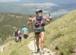
Venturing through the rugged and challenging terrain of Georgia’s hills, the Georgia Jewel 100 is not for the faint of heart. With a daunting 100-mile course boasting over 14,500 feet of elevation gain, this ultra-marathon presents an ultimate test of endurance, determination, and preparation. Held in September, the race comes with its unique set of challenges, including hot and humid conditions and, at times, unpredictable weather. In my Georgia Jewel 100 mile race report, we’ll take you on a journey through the key details of the Georgia Jewel Race, sharing insights on the course, aid stations, and the demanding final leg.
As we navigate the ups and downs of this grueling course, we’ll also highlight some areas for improvement, giving you an honest perspective on this remarkable but demanding race. So, lace up your running shoes and get ready for an epic adventure as we delve into the Georgia Jewel Race.
Key Takeaways from the Georgia Jewel 100 Mile Race Report:
- Course Info: 100-mile distance with over 14,500ft elevation gain.
- Be prepared for hot and humid conditions in September, especially in the Georgia hills.
- The race includes long stretches between aid stations, so hydration and supplies are essential.
- Pay attention to weather conditions, as rain can make some sections of the race more challenging.
- The final 8+ miles without aid at the end can be mentally and physically demanding, so pace yourself accordingly.
- The first climb up Johns Mountain is technical, featuring some awesome caves.
- Finish Area Concerns: Lack of food for runners, limited beer selection, and delayed photo delivery noted as areas for improvement by the race directors.
About the Course
Course Info
Location: Dalton, Georgia
Distance: 100 Miles
Elevation Gain: 14,500ft+
Type: Out and Back
Official Georgia Jewel Race Link
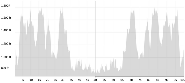
Georgia Jewel 100 Elevation Profile
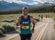
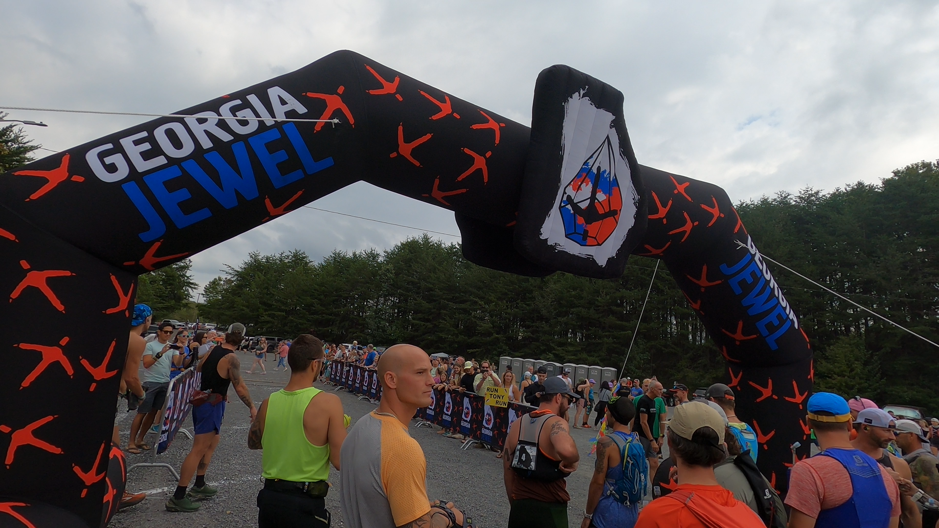
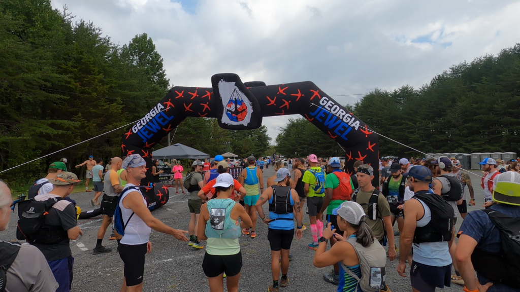
My Georgia Jewel 100 Mile Race Report
The Start to Powerlines – 3.2 miles
The race commences by directing you out of the starting area and down Mt. Baker, which is just as steep as the pre-race rumors suggest. We’re grateful that we’ll be going up it rather than down it at the end of the race.
Once you navigate the steep descent, a nice runnable road section follows, leading to a steady road hill climb, which in turn takes you to the first trail of the race. This trail leads you past the power lines and the aid station.
The Rock Garden to Stover – 8.4 Miles
At the first aid station, it’s crucial to stock up on fluids, as the next stretch is over 8 miles before you’ll reach the next aid station. Expect a hot and humid run through the Georgia hills in September. You can see in my video above that I’m not wearing a shirt or vest, which I believe helped a lot.
The next 8 miles begin with a short gravel road climb to the radio towers at the ridge’s top before you dive into the woods through the rock garden. While it’s not overly challenging, the terrain makes it hard to maintain a steady pace. Fortunately, the front runners have cleared the spider webs for you, but watch out for yellow jackets – many runners, including myself, got stung.
Early in the race, this section goes quickly. It’s a different story on the way back, but I’ll get to that later. As you wind around the ridges, you’ll eventually reach a fire road. The aid station is about half a mile down the road from here.
Heading to Snake Creek – 7.2 Miles
Leaving the aid station, you continue along the fire road, which leads you to a small creek crossing at the valley’s bottom. From there, it’s a relatively easy climb to the next ridge. I really enjoyed this section of the race, as the trail is much more runnable and well-maintained compared to the previous section.
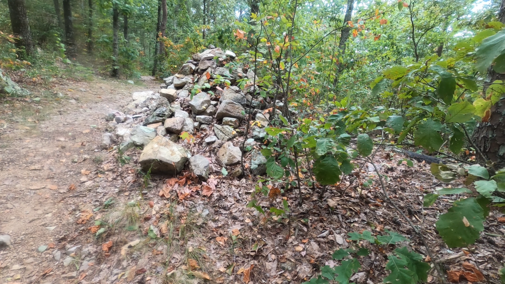
The trail along the ridge weaves, dips, and climbs most of the way. You’ll know you’re about to hit the descent when you see a large rock pile on the right side of the trail.
From there, it’s a very runnable downhill until you reach the aid station. This is also the first place where you’ll have access to your crew.
Off to Pockets Road – 6.5 Miles
Crossing the road from the Snake Creek aid station, you descend briefly before starting to climb again. Fortunately, the trail through this section is well-groomed and not very technical, making it a great section to make up time if you’re feeling behind.
The incline is definitely runnable if you have the energy for it. Once you reach the ridge, you’ll spot another rock pile, and from there, the trail becomes flowy, taking you through one of the peaceful and relaxing parts of the course.
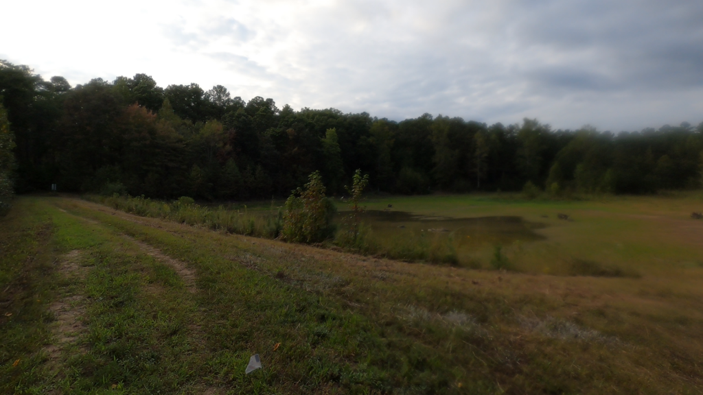
There are beautiful groves, and in the context of Georgia running, it doesn’t get much better. You’ll pass a few small ponds and a flat grassy section leading you to your next road crossing. From there, you’ll follow the fire road to the Pockets aid station at the base of Johns Mountain.
Climbing Johns Mountain For The First Time – 3.3 Miles
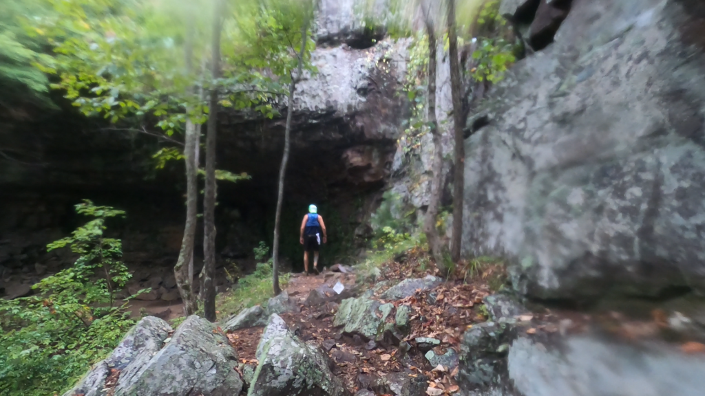
Leaving the Pockets aid station, you’re embarking on the second most challenging climb of the race, and it’s also the most technical section. The trail starts gradually and then becomes rougher as you ascend.
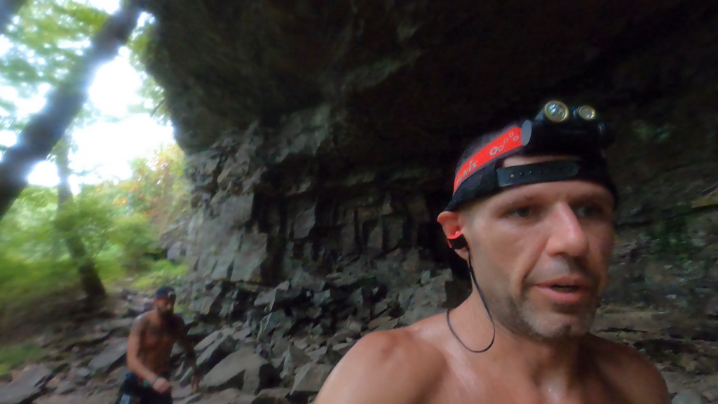
As you climb, you’ll pass by and around some fascinating caves. If it’s rained recently, these caves might even have some water, which can make the technical rocks quite slick. When you reach the stairs, you’re almost at the top, with about 3/4 of a mile around the rim until the aid station.
Heading to Dry Creek – 7.5 Miles
After a short, steep descent on the main road, you’ll head into the woods. This trail is very smooth on the way down and offers a great opportunity to make up time. Eventually, it leads you out onto another fire road, which will take you the rest of the way down the mountain.
This descent is very runnable but will also give your quadriceps a workout, so be prepared. It ends by taking you through a wide, shallow creek crossing that you can’t avoid. If you approach it at night, it might seem wide enough that your initial thought is, “Do I have to swim?” But don’t worry; it’s shallow.
Once across the creek, it’s about a mile to the main Dry Creek aid station. A little tip: if your crew can get there early, park as close to the front as possible. We had about a 0.1-mile walk to the car each time, adding almost a mile to our race.
Dry Creek Loop 1 – 6.7 Miles
From Dry Creek, you’ll be running two separate loops, two times each. This first loop is the shorter of the two and we found it to be the more runnable of the two. We also ran these at night, so I can’t provide many details about the surroundings. But if possible, you should be able to run a good portion of this loop.
Dry Creek Loop 2 – 7.2 Miles
The second loop felt a bit more challenging overall, with more ups and downs. However, there’s still a good amount that you can run. We were able to maintain a good pace through our first times on the loops. There’s a noticeable climb at the end, but by that point, you’re almost back at the aid station and halfway done!
Repeat Loop 1 and Loop 2
Back to Johns Mountain – 7.5 Miles
Leaving Dry Creek for the last time is a great feeling. You’re officially on your way home. As you leave the aid station, you’ll follow the road back to the creek crossing and the biggest climb of the race.
For us, this is when the sun started coming up. It’s also when it started raining hard. So the joy that typically comes with morning sun was hidden behind clouds and heavy rain.
The climb up the fire road isn’t too bad. We certainly weren’t running, but we maintained a good pace. It’s when the trail dives back into the woods that the long distance between aid stations becomes more noticeable. That, and the massive number of spider webs crossing the trail.
The area has a large population of orb-weaver spiders, which, while harmless, are about the size of your hand and leave webs that can stop a person in their tracks. Reaching the fire road and making the final push to the summit and the aid station feels amazing!
Pockets for the Second Time – 3.3 Miles
At this point in our race, the skies had opened up, and a torrential downpour would be an accurate description of the conditions. This made the wooden stairs and technical rocks incredibly slick, forcing us to slow down. We saw three runners from the shorter distance races take a hard fall here, so if it’s wet, be cautious!
A Short Wet Climb to Snake Creek – 6.5 Miles
As I mentioned before, this section is a fantastic piece of trail. Even in the rain, the climb to the ridge was relatively relaxed and enjoyable. Once we reached the ridge, however, the wet conditions and wind created incredibly cold conditions.
It wasn’t just us feeling the cold; all the 100-mile runners we encountered were saying the same thing. We needed to get off of this ridge and fast. Luckily, as I mentioned before, the trail is well-maintained compared to the rest of the race. So, once we descended, we were able to pick up the pace and reach the Snake Creek aid station.
Let’s Get to Stover – 7.2 Miles
After changing socks and adding a few layers, we headed to Stover, our second-to-last aid station. The climb out of the aid station is straightforward if you’re comfortable with climbing. At this point, we’d rather be going up than down. The ridge is smooth, and overall, the 7.2 miles didn’t feel too strenuous as we descended to the small creek. Once you reach the fire road, you can almost smell the aid station ahead.

The Longest 8 Miles of My Life to Power Lines – 8.4 Miles
I won’t sugarcoat it; this section was tough. There weren’t many views, and it felt like you were running the same 150 feet of trail over and over. I read another race report that called this part of the course monotonous, and I completely agree.
Overall, it’s a fantastic event, but these 8+ miles without aid at the end of the race are grueling. It just seems to go on and on. You can’t even see the radio towers through the trees, and for us, the fog was so thick that you could barely see more than 100 feet in front of you.

By this point, Kyle’s feet were in bad shape, so we slowed down considerably. Getting to the gravel road and out of the woods was a huge morale booster. From there, it was only a short downhill to the final Powerlines aid station.
The Final Push – 3.3 Miles
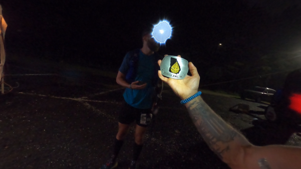
As I mentioned in the section above, Kyle’s feet were in bad shape by this point. But we started together and finished together. So we made our way slowly down the trail to the road section, and as the sun set and darkness set in, we made the final push up Mount Baker, a brutally steep but short climb leading to the parking area and the final 1/4 mile into the finish.
The Finish Area / Post Race
As great as the race was, I must admit that there were a couple of things that I hope the race directors will work on.
Firstly, there was zero food for runners, not even snacks. This was my third 100 miler, and it was the first that didn’t offer any food. Next was the beer selection. I don’t drink much, but I enjoy celebrating my finish with a good local beer. Unfortunately, all that was offered was Michelob Ultra. Lastly, the race featured a photographer taking finishing photos with full lighting and a white background setup. It’s been over a month, and we still haven’t received our photos.
So, for as good as the volunteers were, the race directors could step up their game a bit. They should really provide food for runners, and offering photos and then not providing them is somewhat unprofessional.
Georgia Jewel 100 Race Report – Final Thoughts
Well I hope you found this Georgia Jewel 100 Mile race report helpful! The race is undoubtedly a challenging test of physical and mental endurance, pushing runners to their limits through 100 miles of stunning but demanding terrain. As our race report has shown, this event promises a true adventure for those with the determination to conquer its ups and downs.
From the initial steep climbs to the unpredictable weather conditions and long stretches between aid stations, runners must be well-prepared for the challenges that the Georgia Jewel presents. The technical climbs up Johns Mountain, the exhilarating descents, and the monotonous final leg all make this race a unique and memorable experience.
However, no race is without its areas for improvement, and as we’ve noted, there are some aspects where the race directors could enhance the overall experience for participants. The absence of food for runners, limited beer selection, and delayed photo delivery are aspects that, if addressed, could elevate the event’s overall quality.
Despite these potential improvements, the Georgia Jewel Race remains a remarkable and unforgettable experience for endurance athletes. It’s a journey that tests not only one’s physical capabilities but also their mental resilience and resourcefulness. Those who complete this race can proudly say they’ve conquered one of the toughest ultra-marathons out there.
In the end, the Georgia Jewel Race isn’t just about crossing a finish line; it’s about the journey itself, the camaraderie of fellow runners, and the sense of accomplishment that comes from pushing past your limits. If you’re up for the challenge and prepared for the adventure, the Georgia Jewel Race awaits, promising an unforgettable and life-changing experience for all who dare to take on the hills of Georgia.