Winding through the Sierra Mountains in between and connecting to the Tahoe and Lassen National Forests. The Lost Sierra Route is a new trail system currently in development that will connect 15 of the area’s local communities through over 600 miles over current and new trails. Running in between and into the downtown districts in the surrounding local communities. In a world of ever expanding concrete, I love to bring great news like this.
The Lost Sierra Route – Trail Project Info
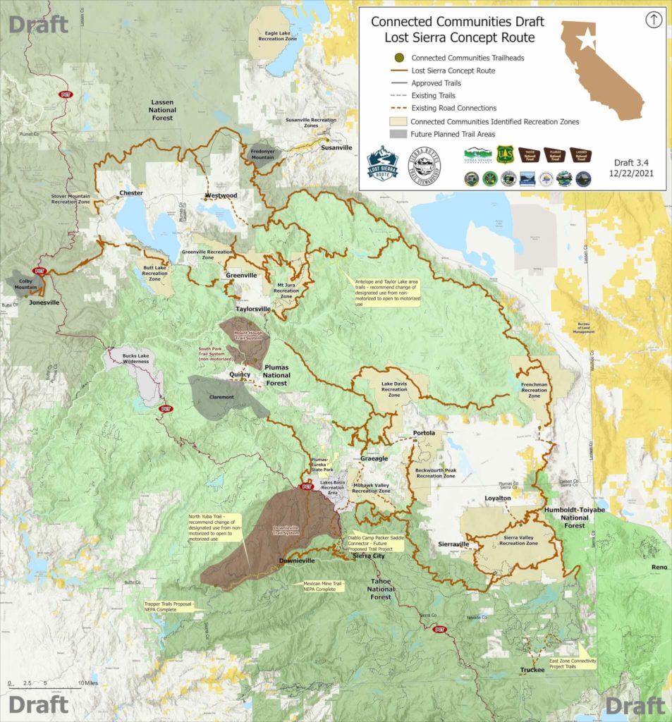
The new trail system’s master plan is being developed by the Sierra Buttes Trail Stewardship in partnership with land managers, local government officials, and the local communities and businesses that will be involved in the trail network. The trail itself will be funded through a mix of public and private donations along with grants from multiple state and federal resources.
The route is being developed in the following four phases:
- Phase 1 – Planning, Mapping and Trails Master Plan Development began 2020
Paid for by Sierra Nevada Conservancy using California Proposition 68 funds - Phase 2 – NEPA/CEQA – environmental review
- Phase 3 – Lost Sierra Route Construction
- Phase 4 – Lost Sierra Route Maintenance
The planners hope that once successful that their master plan will serve as a template for other communities looking to develop new trail systems.
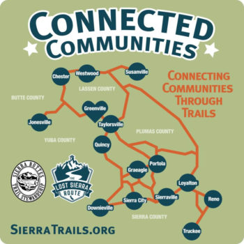
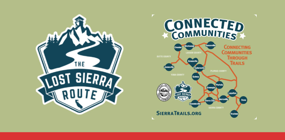
The Communities involved with current project include:
- Chester
- Westwood
- Susanville
- Jonesville
- Greenville
- Taylorville
- Quincy
- Graeagle
- Portola
- Downieville
- Sierra City
- Sierraville
- Loyalton
- Reno
- Truckee
A Trail for Everyone
As part of the project’s development they have put together the “A Trail for Everyone” video to help build awareness. While telling the history of the area and including people from the community. Here it is below:
For more info on the project you can check out the links below.
Master Plan: Click Here
Community Surveys: Click Here
Current Status Report: Click Here