With one of the most popular national parks in the country, Tennessee has no shortage of incredible trails. And while many of the hardest hikes in Tennessee are located in the Smoky Mountain National Park. We have a few that will help you beat the crowds. And enjoy the trails without it feeling like you are hiking in Disneyland.

Key Takeaways
- Tennessee offers challenging hikes in addition to its popular national parks, providing opportunities to explore without the crowds.
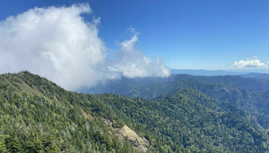
- Some of the hardest hikes in Tennessee include Mount LeConte via Trillium Gap Loop Trail, Thunderhead Mountain, and Rocky Top from Lead Cove Trailhead, all offering varying levels of difficulty and scenic rewards.
- Mount LeConte via Rainbow Falls Trail is a less crowded but challenging alternative to the popular Alum Cave trail, featuring a waterfall and stunning views.
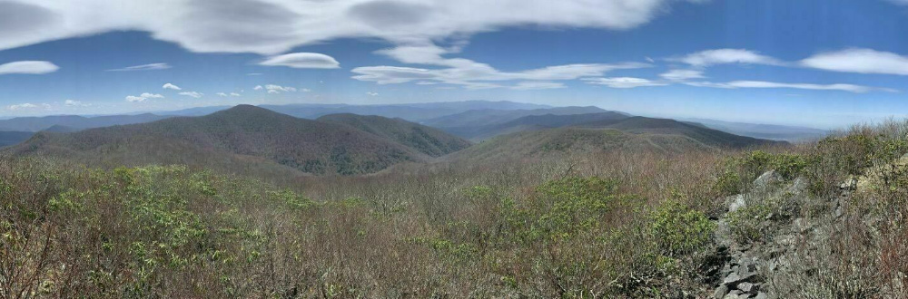
- Thunderhead Mountain from Lead Cove Trailhead offers a hidden gem in the Smoky Mountains with a tough climb, better-than-average views, and a gradual ascent.
- Mt. Sterling via Baxter Creek Trail is known as the hardest hiking trail in the state, featuring the most elevation gain in the shortest distance and an old fire tower at the top.
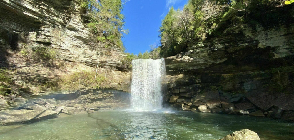
- An honorable mention goes to the Savage Gulf Extended Loop, a long but doable one-day trail with waterfalls, wildlife, and extensive views from the rim, providing a less crowded hiking experience compared to more popular areas like the Smoky Mountains.
A List of The Hardest Hikes in Tennessee
So let’s get to and check out the trails! And as always, if you feel I left anything off the list let me know in the comments below.
Mount LeConte via Trillium Gap Loop Trail
Distance: 14.9 Miles
Type: Loop
Elevation Gain: 4,000ft +
All Trails Link: All Trails Link Click Here
Features: A waterfall and stunning views from the top of Mt. LeConte.
Description:
This is one of two trails on the list that take you to the top of Mt LeConte. One of the most popular mountains in the Smoky Mountain National Park, Trillium Gap loop is less traveled than the more popular Alum Cave trail. That said, with less people comes more of a challenge. But if you haven’t done the Trillium Loop I highly recommend it. As it’s one of my favorite trails in the area.
Thunderhead Mountain
Distance: 14.5 Miles
Type: Out & Back
Elevation Gain: 4,000ft +
All Trails Link: All Trails Link Click Here
Features: Partial views from the top.
Description:
The other way to the top of Thunderhead Mountain. This trail is a bit longer than the Lead Cove Trail. Making for a less steep climb to the top. But that doesn’t mean that it is easy. Hikers that are up for the challenge will be treated to a much less bust trail compared to others in the Smokies. As well as some great views and a handful of small water crossing on small wooden bridges.
Rocky Top from Lead Cove Trailhead
Distance: 10.5 Miles
Type: Out & Back
Elevation Gain: 3,800ft +
All Trails Link: All Trails Link Click Here
Features: Decent views, wild flowers, and lot’s of nature.
Description:
You will notice that the Lead Cove Trailhead is on here twice. Once for this climb to the top of Rock Top mountain and another that features this same trail but continues on to the top of Thunderhead Mountain. This shorter route featuring one peak makes for a great hike for those looking to test their limits. And if you have the juice at the end you can decide whether to make the push to Thunderhead or not.
Mount LeConte via Rainbow Falls Trail
Distance: 13 miles
Type: Out & Back
Elevation Gain: 4,000ft +
All Trails Link: All Trails Link Click Here
Features: A popular trail featuring a waterfall (Rainbow Falls), leading to LeConte Lodge and some great views.
Description:
Mt LeConte is one of the most popular places in the Smoky Mountain National Park to visit. So don’t expect a secluded trail. And while most people will opt for the easier Alum Cave trail. But if you’re looking for a little less people and a bit more of a challenge, then the Rainbow Falls trail is the perfect choice for you.
Thunderhead Mountain from Lead Cove Trailhead
Distance: 12.7 Miles
Type: Out & Back
Elevation Gain: 4,100ft +
All Trails Link: All Trails Link Click Here
Features: A challenging trail featuring better than average views for the area.
Description:
Thunder Mountain is one the hidden gems of the Smokies. Featuring a tough climb from Lead Cove. You will get 4,000+ ft of gain in just over 6 miles on the climb. There are some steep sections but overall it’s a gradual climb. That will reward you with better than average views. Especially once the leaves fall. This is a great winter trail.
Mt. Sterling via Baxter Creek Trail
Distance: 11.7 Miles
Type: Out & Back
Elevation Gain: 4,100ft +
All Trails Link: All Trails Link Click Here
Features: Peek-a-boo views with a charming old fire tower at the top.
Description:
Mt Sterling via Baxter Creek trail features the most gain in the shortest distance of any hike in Tennessee. Earning it the title of the hardest hiking trail in the state. With a steady but not steep climb for just under 6 miles. The reward being the old fire tower at the top of Mt Sterling. Offering great views, which can not be found below in the tree line.
Honorable Mention
Savage Gulf Extended Loop
Distance: 46.3
Type: Loop
Elevation: 7,000ft +
All Trails Link: All Trails Link Click Here
Features: Waterfalls, wildlife and lot’s of views from the rim of the loop.
Description:
I try to avoid “long trails” for the hardest trail series, but while long is a very doable one day trail. Especially for ultra runners looking for a new loop to go and run. Beyond that that Savage Gulf Extended loop features amazing waterfalls, tons of great views from the rim, and lot’s of wildlife. This trail also allows you to get away from people. Something that is not easily done in the more popular areas. Especially the Smoky Mountains which is one of the most visited parks in the country.
Conclusion
Tennessee offers a wealth of challenging hiking opportunities, including some of the toughest trails in the state, which provide a chance to escape the crowds and immerse yourself in nature. From the iconic Mount LeConte and its Trillium Gap Loop Trail to the hidden gem of Thunderhead Mountain, and the challenging Mt. Sterling via Baxter Creek Trail, there are options for hikers of varying levels. For those seeking a less crowded but still demanding adventure, the Mount LeConte via Rainbow Falls Trail and the Savage Gulf Extended Loop provide excellent alternatives in stunning natural settings.
Tennessee’s rugged terrain and diverse landscapes make it a top destination for hiking enthusiasts looking to push their limits and explore the great outdoors. If you have any additional suggestions or insights, please feel free to share them in the comments. Happy hiking!
You also might be interested in: