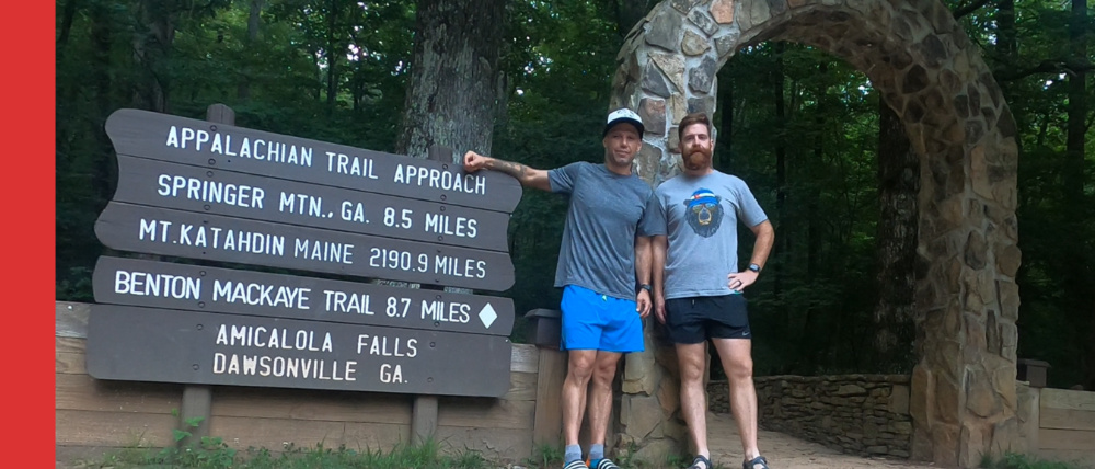
One of the most famous trails in the world, the Appalacian Trail (AT) leads travelers over 2,000 miles from Mt Katahdin Miane, to Springer Mountain Georgia. But what most people don’t know is that the Southern Terminus of the Appalacian Trail doe not start/end at a trail head. It starts at the top of Springer Mountain, some 8+ miles from the nearest major trail head. And while there are a few fire roads you can take to cut the trip short. Most people consider the true southern terminus of the AT is located 8ish miles away at Amicalola Fall in Dawsonville GA. This is the beginning of the Appalachian Approach Trail and the infamous stone arch.
Key Takeaways:
- The true southern terminus of the Appalachian Trail is not at Springer Mountain but at Amicalola Falls in Dawsonville, Georgia, 8+ miles away.
- The Appalachian Approach Trail covers this 17+ mile journey with a substantial elevation gain of over 4,200ft.
- Hikers can explore Georgia’s tallest waterfall, Amicalola Falls, standing at just under 130ft.
- Parking at the trailhead costs $5, payable in cash via a drop box or through the park’s app.
- The “official” trail starts behind the park visitor center and features the famous stone arch.
- This rooty and rocky trail is well maintained and marked.
- Hikers need a water filter as there are two water sources along the trail.
- The first water source is about 1 mile before the first shelter, with another one located across from the shelter.
The Appalachian Approach Trail – Amicalola Falls to Springer Mountain Georgia
Trail Info
Length: 17+ Miles
Type: Out & Back
Elevation Gain: 4,200ft+
AllTrails Link: AllTrails Link Click Here
Description: The Appalachian Approach Trail tales you from the behind the Amicalola Falls visitor center to the top of Springer Mountain. The official southern terminus of the AT.
Discover the natural wonder of Amicalola Falls, Georgia’s tallest waterfall, with a height of nearly 130 feet. The official trail begins at the park visitor center, offering views of the iconic arch and avoiding the challenging stairs at the falls.
The trail is rugged but well-maintained, featuring two water sources that require a filter for safe drinking. One source is located about a mile before the initial shelter, while the other is across from the shelter but further from the path. Parking is available for $5, payable in cash at a drop box or through the park’s app, accessed via the QR code at the entry gate 24/7.
Hiking Appalachian Approach Trail – Tips & Info
- Parking is $5 dollars and can be paid in cash through a drop box or by using the parks app. A QR code with link to the app is posted at the entry gate 24/7.
- The “official” trail starts behind the park visitor center. This is where the famous arch is located. This route will avoid going up the stairs at the falls.
- Amicalola Falls is Georgia’s tallest waterfall at just under 130ft. The name Amicalola Falls means “tumbling water” in Cherokee.
- This trail is incredibly rooty and rocky but well maintained and marked overall.
- There are two water sources on the trail and you will need a water filter. One is roughly 1 mile before the first shelter and there is one across the trail from the shelter. The first water source (not at the shelter) is close to the trail. Only about 50 feet down. The water source at the shelter is much further down.
Conclusion
The Appalachian Approach Trail offers an extraordinary journey to the true southern terminus of the Appalachian Trail, starting at Amicalola Falls in Dawsonville, Georgia. This 17+ mile trek, with a notable elevation gain of over 4,200ft, takes hikers through stunning natural landscapes, including Georgia’s tallest waterfall, Amicalola Falls. The convenience of parking, the iconic stone arch, and the well-maintained trail make it a must-visit for outdoor enthusiasts. Remember to bring a water filter, as there are two water sources along the route.
This trail not only marks the beginning of a remarkable adventure but also stands as a testament to the beauty and challenge that the Appalachian Trail has to offer.