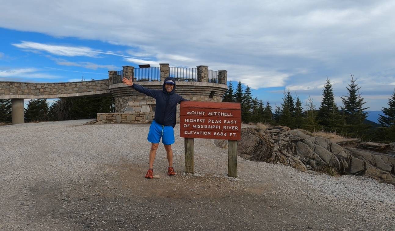
Hiking it to the summit of Mount Mitchell in North Carolina is as challenging as it is rewarding. Offering a combination of brutally rugged trails along with some of the state’s most stunning views. The peak stands as the highest eastern of the Mississippi River, with Mount Mitchell topping out at an elevation of 6,684 feet. Located in the black mountains within Mount Mitchell State Park, which covers over 1,900 acres, the range is known for its rugged and dense forests. And while there is a road that allows people to drive to the top, today we’ll be doing the most popular hiking trail up to the summit, hiking the Mount Mitchell trail.
Starting at the Black Mountain Campground, this is a challenging but surprisingly well-maintained trail. Just expect a ton of rocks and roots. And to better help you on your day out, below I’ll give you my tips for hiking the Mount Mitchell trail, including video and photos. So let’s get hiking!
Hiking The Mount Mitchell Trail – Summit Trail Tips, Info & Video
Distance: 11.2 Miles
Type: Out & Back
Elevation Gain: 3,700 feet
AllTrails Link: Click Here
How long does it take to hike Mount Mitchell?
It takes an average of 7 hours to hike the Mount Mitchell Trail from start to finish. It is 11.2 miles, 5.6 miles up and 5.6 miles down of technical, rocky and rooty trail. Which can be just as slow going down as it is going up.
Quick Tips for the Trail:
- Be prepared for any weather. Mount Mitchell has recorded snow during 12 months of the year, and the temps are often 20+ degrees cooler at the summit.
- The weather can change quickly and drastically. Again, make sure you have the right clothes for the weather including a waterproof jacket.
- Make sure you have the right footwear. The trail is well marked, but incredibly technical with roots and rocks.
- While the trail is tough going up, it can be more dangerous on the way down. With some steep drops on often slick rocks.
- Bring water and a filter. The hike up typically takes people longer than they expect. So make sure you bring water and a water filter for a backup.
- Bring some snacks. Again, this one may take longer than expected, so bring some snacks.
- Don’t leave any valuables inside your car. Unfortunately car break ins are becoming more common at trails heads. Just make sure everything is out of sight and take your phone and wallet.
Review of the Mount Mitchell Hike:
The Mount Mitchell trail features just under 12 miles round trip and roughly 3,600ft of elevation gain. The trailhead is located at the Black Mountain Campground, in the Mount Mitchell State Park. And is accessible even when the campground is closed. With a parking lot located across the bridge from the campground. When I was there, I didn;t see anywhere to pay for parking, so I’m assuming it is free. Once you enter the campground the trail head starts to your left. You will see the blue blazes and mile markers will guide you every half mile all the way to the summit.
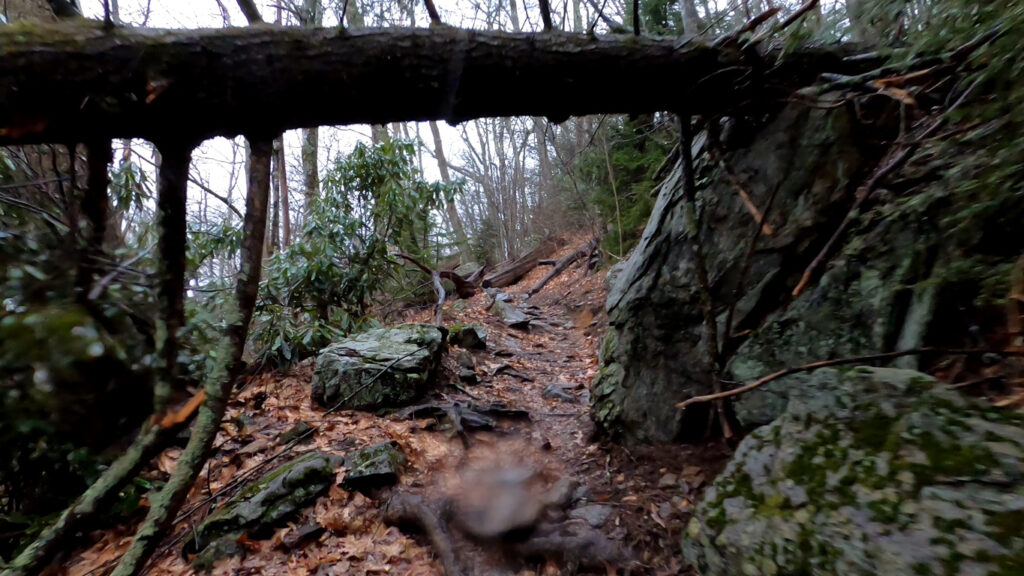
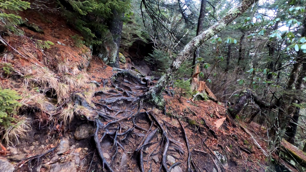
The trail starts somewhat flat as you start following the river, but will soon take a right leading you up the mountain. One thing I can say about the Mount Mitchell trail is that it is consistent. You will gain around 600 feet each mile over the first 6 miles. And each mile feels as though it has more rocks and roots than the last. It’s consistently technical from start to finish. So at least you know what to expect.
Making the Summit of Mount Mitchell
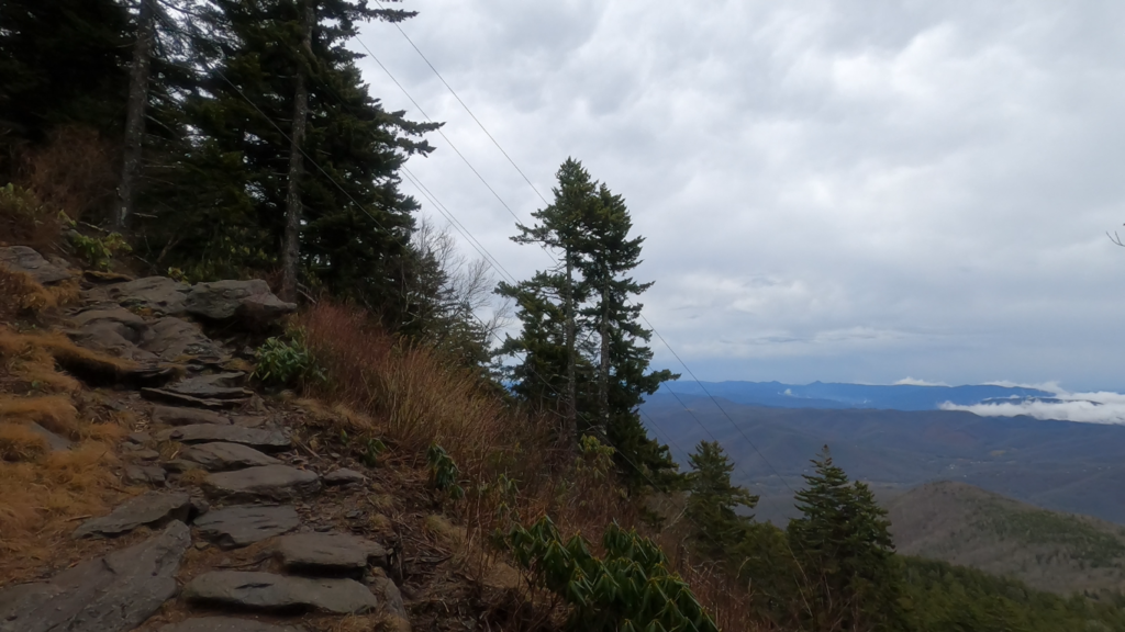
I will say there is one section that stands out from the rest. At about mile 4 you will hit the powerline switchback. That section is probably the most difficult of the entire climb. So enjoy the view and the suffering that goes along with it.
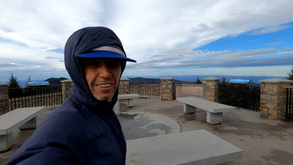
Making your final push you can expect the wind to kick up. Along with some cool rock formations close to the top. Once you start to level off you will know you are almost there. With the trail clearing to the paved path leading to the top. Take the left to take you to the viewing platform. But catching an open view is considered lucky as cloudy days are common at the peak. But as you can see in the video. I started out with rain but lucked out with a view and having the summit to myself!
Closing Thoughts on Hiking The Mount Mitchell Trail
If you’re looking for a challenge or just want to tag the highest point east of the Mississippi River, hiking the Mount Mitchell trail should definitely be on your list. You will have to earn the view at the top. Tackling miles of roots and rocks o a trail that has been carved over the years by water flowing down the mountain. And while there are other, even more technical routes up the mountain. Check out the Black Mountain Crest Trail, if you really want a challenge. This is the perfect route for most people to choose, especially for their first ascent. And you will probably be shocked that this is considered the easiest trail from the base of the mountain to the summit.
In closing, just make sure you are ready for any weather on this one. Bring water and a way to filter water, just in case you get stuck for a while. And always bring more food than you expect to need. And like always, if you have any questions let me know in the comments below!